
Lake News Alerts
We'd like to send you lake news articles, videos, and podcasts from around the web.
 We will never share your email
|
Lakes in Texas, United States
MAJOR LAKES
|
|
|
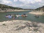
An oasis in the desert, Amistad National Recreation Area consists of the U.S. portion of the International Amistad Reservoir. Amistad, whose name comes from the Spanish word meaning friendship, is best known for excellent water-based recreation, camping, hiking, rock art viewing, and it's rich cultural history. Amistad is also home to a wide vari...
|
|
|

|
Aquilla Lake is located approximately seven miles southeast of Hillsboro or approximately twenty-three miles north of Waco in Hill County, on Aquilla Creek and Hackberry Creek, tributaries of the Brazos River.
The dam is part of the overall flood control project in the Brazos River basin. The lake is owned by the U.S. Government and operated ...


Full Pool: 537.5 MSL
Area: 7,000 Acres
|
|
|

|
Lake Arrowhead is located about 13 miles southeast of Wichita Falls, Texas on the Little Wichita River, a tributary of Red River. Lake Arrowhead Dam was primarily designed and constructed for water supply and recreational purposes. The City of Wichita Falls owns the water rights to Lake Arrowhead. It also owns and maintains the dam and appurtenant ...


Full Pool: 926.0 MSL
Area: 14,969 Acres
|
|
|
|
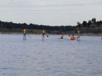
With 136 miles of shoreline, Lake Belton visitors enjoy boating, camping, picnicking, and nature trails. Largemouth, white, smallmouth, and hybrid striped bass have been stocked, as well as catfish, sunfish, bluegill, crappie, longnose gar, and alligator. Lake Benton is also home to many species of songbirds, hawk, great blue herons, and many other...
|
|
|

|
Big Lake is an intermittent dry lake located southwest of the city of Big Lake, Texas....
|
|
|

|
The lake lies in Titus, Camp, and Franklin Counties, with a small part in the northeast corner of Wood County. The park covers 641 acres of land on the northern shore of the lake in Titus County about 10 miles southwest of Mount Pleasant.
Campgrounds with hookups, covered shelters, fishing pier on lake, boat ramp.
Hiking, piknicking, fishing (P...
|
|
|

|
Lake Bridgeport is located in North Texas and was created by damming the Trinity River. The lake is owned by the Tarrant Regional Water District and the water is used for irrigation, flood control, and recreation. Construction of the lake’s dam began in 1929 and was completed in 1931. Lake Bridgeport is a popular freshwater fishing spot for angle...


Full Pool: 836.0 MSL
Area: 12,940 Acres
|
|
|

|
Brownwood Lake is located on Pecan Bayou and Jim Ned Creek, 70 miles southeast of Abilene and about 10 miles north of the city of Brownwood.
Activities include picnicking, camping, hiking, boating, water skiing, fishing, nature study, swimming, and bird watching. Brownwood State Park offers a variety of recreational and educational opportunities...


Full Pool: 1,425.0
Area: 6,490 Acres
|
|
|
|
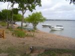
Lake Buchanan was formed by the construction of the Buchanan Dam by the Lower Colorado River Authority. The lake provides water supply for the region and hydroelectric power. Buchanan Dam was completed in 1939. Lake Buchanan was the first of the Texas Highland Lakes to be formed, it is also the largest.
The lake is named for Representative James...
|
|
|

|
Caddo Lake is a 25,400 acres lake and wetland located on the border between Texas and Louisiana, in northern Harrison County and southern Marion County in Texas and western Caddo Parish in Louisiana. The lake is named after the Southeastern culture of Native Americans called Caddoans or Caddo, who lived in the area until their expulsion in the 19th...
|
|
|
|
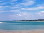
Canyon Lake was formed on the Guadalupe River by Canyon Dam. The Corps of Engineers have built and maintain eight park areas around the lake. These parks provide campgrounds, beaches, picnic areas, boat ramps, and opportunities for shoreline fishing. Comal County also provides several boat ramps for access to the lake. Many trails are available for...
|
|
|

|
Cedar Creek Reservoir is located southeast of Dallas, Texas. It is built on Cedar Creek, which flows into the Trinity River.
The Texas Parks and Wildlife Department maintains three islands that are used for a Wildlife Management Area for aquatic birds. The lake is owned by the Tarrant Regional Water District, and supplies water to neighboring ci...
|
|
|

|
Choke Canyon Reservoir is 4 miles west of the town of Three Rivers and about 65 miles south of San Antonio. Along with providing drinking water for Corpus Cristi, the reservoir also a great outdoor activity destination.
Located on the shores of Choke Canyon Reservoir, the Choke Canyon State Park provides multiple outdoor activities including boa...
|
|
|

|
LOCATION
Lake Conroe is located one hour north of downtown Houston on the
West Fork of the San Jacinto River in Montgomery and Walker Counties.
RESERVOIR CONTROLLING AUTHORITY
San Jacinto River Authority
Conroe Project Office
PO Box 329
Conroe, Texas 77305
(936) 588-1111
PUBLIC ACCESS FACILITIES
The National Forest Service ...
|
|
|

|
LOCATION
Cooper lake is located on the Middle and South Forks of the Sulphur River, northwest of Sulphur Springs in Delta and Hopkins counties. The main body of the lake is located in-between Hwy 19 and Hwy 24, twenty miles north of I-30.
DIRECTIONS TO JIM CHAPMAN/COOPER LAKE
Heading West on I-30, from Texarkana, take exit 127 to loop 3...


Full Pool: 440.0 MSL
Area: 19,305 Acres
|
|
|

|
*** Notice *******************- Due to drought conditions, there are no public boat ramps available on this lake.
- Fish populations have been severely damaged by chronic


 Full Pool: 1,898.0
Area: 14,950 Acres
|
|
|

|
Eagle Mountain Lake is a freshwater lake located in North Texas. The lake was created by damming the Trinity river. The lake's dam was completed on October 24, 1932....
|
|
|

|
Falcon International Reservoir, commonly called Falcon Lake, is located on the Rio Grande, southeast of Laredo, Texas and Nuevo Laredo, Mexico. The huge lake is bounded by the Texas-Mexico border. The reservoir was formed by the construction of the Falcon Dam to provide water conservation, irrigation, flood control, and hydroelectricity to the area...
|
|
|
|
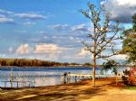
Lake Fork is located on the Sabine River in Hopkins, Rains and Wood Counties, 5 miles northwest of Quitman.
RESERVOIR CONTROLLING AUTHORITY
Sabine River Authority of Texas
Box 487
Quitman, TX 75783
(903) 878-2262
The Sabine River Authority (903) 878-2262 operates four public boat ramps and a free day use area on Lake Fork. Ther...
|
|
|

|
Grapevine Lake is a freshwater lake located in the north Texas area. It was impounded in 1952 by the US Army Corps of Engineers when they dammed Denton Creek. The lake's primary purposes are flood control and to act as a water reservoir, but it also functions as a recreation and natural land area. The Grapevine Dam and Reservoir project was initiat...
|
|
|
|
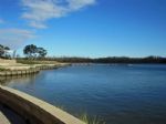
Lake Houston is a reservoir on the west fork of the San Jacinto River in Texas. The reservoir is the primary municipal water supply for the city of Houston and much of the surrounding area. It was created in 1953 when the City of Houston built the Lake Houston Dam. The Texas Parks and Wildlife Department use the lake for a waterfowl sanctuary and a...
|
|
|

|
Hubbard Lake is located in Sandy Creek, Hubbard Creek and Brushy Creek in Stephens County, 51 miles northeast of Abilene and about five miles west of Breckenridge.
RESERVOIR CONTROLLING AUTHORITY
West Central Texas Municipal Water District
410 Hickory Street
Abilene, Texas 79601
(325) 673-8254
There are several marinas and fishing pier...


Full Pool: 1,183.0 MSL
Area: 14,922 Acres
|
|
|

|
Lake J B Thomas Dam is a dam located just 15.7 miles from Snyder, in Scurry County, in the state of Texas, United States, near Knapp, TX.
...


Full Pool: 2,258.0 MSL
Area: 7,820 Acres
|
|
|

|
Jim Chapman Lake, also known as Cooper Lake, is operated by the Army Corps of Engineers and is located east of the Dallas/Fort Worth Metroplex in the state of Texas. The lake provides water supply storage for the North Texas Municipal Water District. The lake is known as a perfect location for fishing and is stocked with multiple species of fish, i...


Full Pool: 440.0 MSL
Area: 19,305 Acres
|
|
|

|
Joe Pool Lake is a fresh water impoundment located in North Texas.The lake was named after Joe Pool, a congressman from the Oak Cliff area of Dallas. Construction of the lake began in 1977 and was completed in December 1985. Impoundment of water began in January 1986 and the lake was filled by June 1989.
Joe Pool Lake supplies the public with se...


Full Pool: 522.0 MSL
Area: 6,469 Acres
|
|
|

|
Lake Kemp is located on the Wichita River north of Seymour, off US 183.
RESERVOIR CONTROLLING AUTHORITY
City of Wichita Falls
1300 7th Street
Wichita Falls, Texas 76307
(940) 761-7477
Seven boat ramps can be reached from three toll gates around the lake. Gate entrance fees are $15 per person for a 3-day pass or $500 for an annual pa...


Full Pool: 1,144.0 MSL
Area: 15,590 Acres
|
|
|

|
*********** NOTICE *************
This area is experiencing a drought which may affect fishing and boat ramp access. Before you go, check the current lake level or contact the controlling authority for current conditions.
********************************
Lake Kickapoo is located about ten miles northwest of Archer ...


Full Pool: 1,045.0 MSL
Area: 6,028 Acres
|
|
|
|
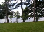
Lake O' the Pines includes about 18,700 acres of water and 9,000 acres of land located in the piney woods of Northeast Texas. The lake is located partially in Marion, Harrison, Upshur, Morris and Camp Counties. Recreation opportunities are numerous with camping, boating, fishing, hunting, watchable wildlife, and bird watching, including wintering b...
|
|
|

|
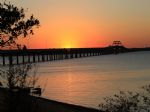
Lake Lavon is located in North Texas on the Trinity River. Lake Lavon's dominant fish species are the largemouth bass, white bass, blue catfish, and crappie. The lake was designed for flood control, conservation storage, and recreational use. The project was started in 1948 and completed in 1953....
|
|
|
|
Lewisville Lake is a reservoir located in North Texas (USA) near the city of Lewisville on the Elm Fork of the Trinity River in Denton County. The lake is primarily used recreationally for boating and watercraft, however, it was built for flood control purposes and to serve as a water source for Dallas and its suburbs.
Lewisville Lake (former...
|
|
|

|
Lake Limestone is located near Thornton, Texas. The lake's water is slightly alkaline and moderately clear, with a maximum of 42 feet deep. The Lake is controlled by the Brazos River Authority. Lake Limestone is widely used for recreational activities including fishing, motor boating, jet skiing, and swimming....


Full Pool: 363.0 MSL
Area: 13,680 Acres
|
|
|
|
Lake Livingston is a reservoir located in the East Texas. The lake is owned and operated by the Trinity River Authority of Texas. Trinity River Authority of Texas also built the dam, construction began in 1966 and was completed in 1969.
....
|
|
|

|
Lake Lyndon B. Johnson is located on the Colorado River in the Texas Hill Country in the United States. The reservoir was formed in 1950 by the construction of Granite Shoals Dam by the Lower Colorado River Authority. The Colorado River and the Llano River meet in the northern portion of the lake. The dam was renamed Wirtz Dam in 1952 for Alvin J. ...
|
|
|

|
Lake Medina is a reservoir on the Medina River located 40 miles northwest of San Antonio, Texas in Bandera and Medina counties. It is operated by the Bexar / Medina / Atascosa County Agricultural District. Medina Dam was completed in 1913, creating the lake to supply irrigation water for local agricultural use, but it is now also used for recreat...


Full Pool: 1,062.0 MSL
Area: 5,575 Acres
|
|
|
|
Lake Meredith is a reservoir located 45 miles northeast of Amarillo on the Canadian River formed by Sanford Dam on the Canadian River in Sanford, Texas. It is a major source of drinking water for Amarillo and Lubbock.
Camping and/or picnic facilities are available at 13 developed areas around the lake. The National Park Service provides boat ram...


Full Pool: 2,941.0 MSL
Area: 16,505 Acres
|
|
|

|
Navarro Mills Lake is located North of Texas 31 between Waco and Corsicana.
RESERVOIR CONTROLLING AUTHORITY
U.S. Army Corps of Engineers
1175 FM 667
Purdon, Texas 76679
(254) 578-1431
PUBLIC ACCESS
The Army Corps of Engineers ...


Full Pool: 424.5 MSL
Area: 5,070 Acres
|
|
|

|
"O. C. Fisher Lake (also known as O.C. Fisher Reservoir, formerly known as San Angelo Lake) is located at the northwestern outskirts of San Angelo in Tom Green County, on North Concho River, a tributary of Concho River which is a tributary of the Colorado River. The lake is owned by United State of America and operated by U S Army Corps of Enginee...


Full Pool: 1,908.0
Area: 5,348 Acres
|
|
|

|
O.H. Ivie Reservoir is located on the Colorado and Concho Rivers in Concho, Coleman, and Runnels counties, 55 miles east of San Angelo.
RESERVOIR CONTROLLING AUTHORITY
Colorado River Municipal Water District
PO Box 869
Big Spring, Texas 79721-0869
(432) 267-6341
...
|
|
|

|
Lake Palestine is a freshwater lake in northeast Texas. It is located on the Neches River, 15 miles southwest of Tyler on Texas 155. It was created by the construction of the Blackburn Crossing dam on the Neches River in 1962.
RESERVOIR CONTROLLING AUTHORITY
Upper Neches River Authority
PO Box 1965
Palestine, Texas 75802
(903) 876-2237
...
|
|
|

|
Pat Mayse Lake is located 15 miles north of the city of Paris on US 271, 3 miles west on FM 906.
Overview
Pat Mayse West Campground is on the banks of its namesake lake in the Red River Basin in Lamar County, Texas. Easy access to developed park areas has made the lake a haven for families who enjoy camping, picnicking, swimming, boati...


Full Pool: 451.0 MSL
Area: 5,940 Acres
|
|
|
|
Possum Kingdom Lake, also known as P.K, is a reservoir on the Brazos River in Palo Pinto and Young counties, 75 miles west of Fort Worth off Texas Highway 16.
RESERVOIR CONTROLLING AUTHORITY
Brazos River Authority
Star Route
Graford, Texas 76025
(940) 7...


Full Pool: 1,000.0 MSL
Area: 17,700 Acres
|
|
|

|
This lake was built for municipal water supply but also features a lakeside power generating plant. Much of the north end retains its original standing timber. Shoreline areas have some vegetation. Water is fairly turbid, rather fertile and a maximum of 40 feet deep.
Ray Hubbard Lake was created over Corder Lake, which used to be under the HWY ...
|
|
|

|
Ray Roberts Lake is One of Texas' newest lakes with a surface area of 29,350 acres. The dam is located at river mile 60 on the Elm Fork of the Trinity River. It's found midway between the towns of Sanger and Pilot Point, approximately 12 miles northeast of Denton off I-35. The lake and Dam are owned by the cities of Dallas and Denton.
It is a p...
|
|
|

|
Red Bluff Reservoir is on the Pecos River in Texas and extends into New Mexico. The reservoir was formed in 1936 by the construction of a dam via the Red Bluff Water Control District. It was built to provide water for irrigation and hydroelectric power, but is also used for multiple recreational activities. Red Bluff Reservoir has been stocked wit...


Full Pool: 2,827.1 MSL
Area: 11,193 Acres
|
|
|

|
Lies on both Chamber and Richland Creeks just east of Corsicana off U.S. Highway 287. The dam stands in Freestone County but most of the lake spills into Navarro County. This Y-shaped lake was built for municipal water supply but also provides excellent recreation. The main river arms still have acres of standing timber and brush that has yet to ro...
|
|
|

|
Sam Rayburn Reservoir is located deep in the east Texas Piney Woods Forests just north of Jasper, Texas. The lake is nationally known for its largemouth bass fishery and is home to over 300 fishing tournaments each year. Visitors enjoy boating, fishing, camping, picnicking, hiking, swimming, birding, wildlife viewing, and other fun activities.
...
|
|
|

|
Somerville Lake is owned and operated by the U.S. Army Corps of Engineers; it is located northwest of Brenham, Texas. The dam lies in Washington County, and is also managed by the U.S. Army Corps of Engineers. The reservoir was impounded in 1967; it provides flood control, water for irrigation, and a site for recreational activities.
The U.S. Ar...


Full Pool: 238.0 MSL
Area: 11,456 Acres
|
|
|

|
Lake Stamford is located in Haskell County, Texas. This lake was completed in 1953 and provides water to Stamford and neighboring towns along with recreational activities. Boating, fishing, swimming, camping, and hiking are among the popular activities on the lake. The lake features it's own marina, as well....


Full Pool: 1,417.0 MSL
Area: 5,124 Acres
|
|
|

|
B A Steinhagen Reservoir is located near the town of Jasper, Texas in the east Texas Piney Woods at 30.85 North Latitude and 94.19 West Longitude. The borders of Tyler County and Jasper County are defined by the bed of the Neches River, and therefore bisect the lake on a North/South line. The lake was created as part of a project that focused on cr...


Full Pool: 82.4 MSL
Area: 10,687 Acres
|
|
|

|
Stillhouse Hollow Lake is located on the Lampasas River, southwest of Belton, Texas. The lake is also used as a recreational and wildlife area. Stillhouse Hollow Dam and the reservoir are both managed by the U.S. Army Corps of Engineers. Most of the lake is man made and was officially impounded in 1968. It provides flood control, water supply and i...
|
|
|

|
Lake Tawakoni is a reservoir located east of Dallas, Texas. It lies within three Texas counties and is used for water supply and recreation. The reservoir was constructed in 1960. It is owned by the Sabine River Authority of Texas.
...
|
|
|

|
Lake Texana is a reservoir on the Navidad River, 8 miles east of Edna, in Jackson County, Texas. The reservoir is formed by the construction of Palmetto Bend Dam. The dam and lake are managed by the Lavaca-Navidad River Authority, and supply water to surrounding communities and industries. Lake Texana is the only reservoir managed by the Authority....


Full Pool: 44.0
Area: 9,727 Acres
|
|
|

|
Lake Texoma is one of the largest reservoirs in the United States, it is formed by Denison Dam on the Red River situated between Oklahoma and Texas. The lake area includes two wildlife refuges, twenty-six resorts, two state parks, twelve marinas, hundreds of campgrounds, fifty four USACE-managed parks, and a variety of golf courses. Power boating, ...
|
|
|

|
Toledo Bend Reservoir is a reservoir on the Sabine River between Texas and Louisiana. the largest man-made body of water in Texas, the largest in the South, and the fifth largest in the United States.
The land along the Orange area often flooded from the Sabine, with destructive effects. Also, the considerations for municipal, industrial, agricu...
|
|
|

|
This lake is in the middle of the Highland Lake Chain. It offers 65 miles of clear, rather infertile water with 270 miles of shoreline. Limestone bluffs drop into water as deep as 190 feet, making this one of the deepest lakes in Texas. Rocky points provide the main fish habitat....
|
|
|

|
Twin Buttes Reservoir was established to provide flood control, irrigation, water conservation, and a primary drinking water source for San Angelo and the surrounding communities in Tom Green County. The lake also serves as a recreational venue for fishing, boating, and swimming. The dam and reservoir are owned by the United States Bureau of Reclam...


Full Pool: 1,940.0 MSL
Area: 23,508 Acres
|
|
|

|
Lake Waco is a reservoir located within the city limits of Waco, Texas. The dam is located on the Bosque River. The lake is currently run by the Army Corps of Engineers. Lake Waco was raised about 8 feet in 2005, and this has helped with fishing....


Full Pool: 462.0 MSL
Area: 7,270 Acres
|
|
|

|
Lake Whitney is a reservoir on the Brazos River in Texas. The lake was built for flood control and hydro-electrical power, but also serves as a great area for recreation. The lake is part of the Texas Lakes Trail Region of North Texas. The dam's construction started in 1947 and lasted four years. The lake was impounded in 1951 and the dam's power p...
|
|
|

|
Lake Worth is located on the Trinity River and is inside the Fort Worth, Texas city limit. The lake was built in 1914 and is controlled by the City of Fort Worth Lake Worth Management Office....


Full Pool: 594.0 MSL
Area: 8,736 Acres
|
|
|
|
Wright Patman Lake is located in northeast Texas and is a U.S. Army Corps of Engineers reservoir formed on the Sulphur River by Wright Patman Dam. The reservoir provides flood control and water conservation, but is also a popular recreational destination.
Construction of the dam began in 1948 and the lake was formed when water was impounded in 1...
|
|
|
|
OTHER LAKES IN TEXAS
(alphabetical)
|
|
Lake Name
|
Full Pool *
(MSL) **
|
Acres
|
River
|
Map
|
|
Abilene
|
2,012.0
|
595
|
|
|
|
Alan Henry
|
2,224.0
|
2,884
|
Double Mountain Fork Brazos River
|
|
|
Amon Carter
|
920.0
|
1,848
|
West Fork Trinity River
|
|
|
Arlington
|
550.0
|
2,275
|
West Fork Trinity River
|
|
|
Athens
|
440.0
|
1,799
|
Neches River
|
|
|
Austin
|
492.8
|
1,830
|
Colorado River (Texas)
|
|
|
Back
|
|
|
|
|
|
Ballinger
|
1,668.0
|
591
|
Colorado River (Texas)
|
|
|
Bardwell
|
421.0
|
3,570
|
Trinity River
|
|
|
Benbrook
|
694.0
|
3,770
|
Trinity River
|
|
|
Bonham
|
565.0
|
1,020
|
Red River
|
|
|
Brady Creek
|
1,743.0
|
2,020
|
San Saba River
|
|
|
Brandy Branch
|
340.0
|
1,242
|
Sabine River
|
|
|
Braunig
|
506.5
|
1,350
|
San Antonio River
|
|
|
Buffalo Creek
|
1,049.0
|
1,576
|
Colorado River (Texas)
|
|
|
Buffalo Springs
|
|
241
|
Brazos River
|
|
|
Calaveras
|
485.0
|
3,624
|
Calaveras River
|
|
|
Champion Creek
|
2,083.0
|
1,577
|
Colorado River (Texas)
|
|
|
Cherokee
|
280.0
|
3,987
|
Sabine River
|
|
|
Cisco
|
1,520.0
|
1,050
|
Brazos River
|
|
|
Clinton
|
|
|
|
|
|
Coleman
|
1,718.0
|
2,000
|
Colorado River (Texas)
|
|
|
Coleto Creek
|
98.3
|
3,100
|
Guadalupe River
|
|
|
Colorado City
|
2,070.2
|
1,655
|
Colorado River (Texas)
|
|
|
Corpus Christi
|
94.0
|
18
|
Nueces River
|
|
|
Crook
|
477.0
|
1,226
|
Red River
|
|
|
Cypress Springs
|
378.0
|
3,461
|
Red River
|
|
|
Dunlap
|
575.8
|
410
|
Guadalupe River
|
|
|
Eddleman
|
1,075.0
|
650
|
Brazos River
|
|
|
Electra
|
|
731
|
Red River
|
|
|
Ellison Creek
|
268.0
|
1,516
|
Red River
|
|
|
Fairfield
|
310.0
|
2,159
|
Trinity River
|
|
|
Fayette County
|
390.0
|
2,400
|
Colorado River (Texas)
|

|
|
Fryer
|
2,641.0
|
86
|
Trinity River
|
|
|
Georgetown
|
791.0
|
1,297
|
Brazos River
|
|
|
Gibbons
|
247.0
|
131
|
Navasota River
|
|
|
Gibbons Creek
|
245.0
|
2,770
|
Navasota River
|
|
|
Gladewater
|
300.0
|
481
|
Sabine River
|
|
|
Graham
|
1,075.0
|
1,900
|
Brazos River
|
|
|
Granbury
|
693.0
|
1,350
|
Brazos River
|
|
|
Granger
|
504.0
|
4,400
|
Brazos River
|
|
|
Halbert
|
368.0
|
649
|
Trinity River
|
|
|
Hawkins
|
374.0
|
633
|
Sabine River
|
|
|
Holbrook
|
363.0
|
653
|
Sabine River
|
|
|
Hords Creek
|
1,900.0
|
510
|
Colorado River (Texas)
|
|
|
Houston County
|
260.0
|
1,282
|
|
|
|
Hubert M Moss
|
715.0
|
1,125
|
Red River
|
|
|
Inks
|
886.9
|
837
|
Colorado River (Texas)
|

|
|
Jacksonville
|
422.0
|
1,320
|
Neches River
|
|
|
Kiowa
|
|
563
|
|
|
|
Lady Bird
|
428.0
|
416
|
Colorado River (Texas)
|
|
|
Lake Corsicana
|
|
|
|
|
|
Leon
|
|
1,590
|
Leon River
|
|
|
MacKenzie
|
3,100.0
|
896
|
Prairie Dog Town Fork Red River
|
|
|
Magnolia
|
|
87
|
|
|
|
Marble Falls
|
737.0
|
611
|
Colorado River (Texas)
|
|
|
Martin Creek
|
306.0
|
4,981
|
Sabine River
|
|
|
McQueeney
|
|
396
|
Guadalupe River
|
|
|
Mexia
|
448.3
|
1,048
|
Navasota River
|
|
|
Millers Creek
|
1,334.0
|
2,212
|
|
|
|
Mineral Wells
|
863.0
|
440
|
Brazos River
|
|
|
Moss Creek
|
2,337.0
|
|
|
|
|
Mountain Creek
|
457.0
|
2,490
|
Trinity River
|
|
|
Murvaul
|
265.5
|
3,397
|
Sabine River
|
|
|
Nacogdoches
|
279.0
|
2,212
|
Neches River
|
|
|
Nasworthy
|
1,855.0
|
1,380
|
South Concho River
|
|
|
Natural Dam Salt
|
2,457.0
|
2,276
|
|
|
|
Nocona
|
827.0
|
1,323
|
Red River
|
|
|
Oak Creek
|
2,000.0
|
2,375
|
|
|
|
Palo Pinto
|
867.0
|
2,661
|
Brazos River
|
|
|
Pat Cleburne
|
733.6
|
1,550
|
Nolan River
|
|
|
Phantom Hill
|
1,635.9
|
4,213
|
Brazos River
|
|
|
Placid
|
|
198
|
|
|
|
Proctor
|
1,162.0
|
4,610
|
Leon River
|
|
|
Purtis Creek
|
|
349
|
|
|
|
Sabine
|
|
|
Sabine River
|

|
|
Sheldon
|
|
1,230
|
|
|
|
Squaw Creek
|
775.0
|
3,275
|
Brazos River
|
|
|
Striker
|
292.9
|
1,863
|
|
|
|
Sweetwater
|
2,116.0
|
630
|
|
|
|
Tyler
|
375.5
|
2,224
|
Neches River
|
|
|
Tyler East
|
375.0
|
3,584
|
|
|
|
Waxahachie
|
|
690
|
|
|
|
Weatherford
|
896.0
|
1,090
|
|
|
|
Welsh
|
320.0
|
1,365
|
|
|
|
White River
|
|
1,477
|
Brazos River
|
|
|
White Rock
|
|
|
|
|
|
Winnsboro
|
419.0
|
806
|
Sabine River
|
|
* Full Pool - Highest normal summer pool level before flood stage
** MSL - Mean (average) feet above sea level
|
|

