
Lake News Alerts
We'd like to send you lake news articles, videos, and podcasts from around the web.
 We will never share your email
|
Lakes in Missouri, United States
MAJOR LAKES
|
|
|
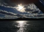
Bull Shoals Lake offers diverse wildlife species, varied fisheries, open waters for sailing and boating, picnic shelters and swimming areas, boat ramps, and scuba opportunities. Visitors enjoy these and many other recreational opportunities. The reservoir lies in the beautiful Ozark Mountains of northern Arkansas and southern Missouri.
The woo...
|
|
|

|
Mark Twain Lake is located in Ralls County, Missouri and Monroe County, Missouri. It was created by the Clarence Cannon Dam impounding the Salt River and is located about twenty miles southwest of Hannibal. It was named for Missouri author Mark Twain (pen name of Samuel Clemens) and part of the area around it is Mark Twain State Park. The village o...
|
|
|
|
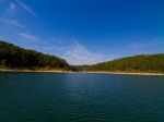
In the late 1930's, before construction of the Norfork Dam had begun, the local economy of Baxter County, Arkansas was deteriorating. The yearly per capita income had fallen to between one-hundred and two-hundred dollars, and in 1940 alone more than six hundred small farms were abandoned. Those who remained looked forward with enthusiasm to any sol...
|
|
|
|
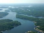
The Lake of the Ozarks is a large reservoir created by impounding the Osage River in the northern part of the Ozarks in central Missouri. Extents of three smaller tributaries to the Osage, the Niangua River, Grandglaize Creek, and Gravois Creek, are included in the impoundment. The lake has a surface area of 55,000 acres, over 1,150 miles of shorel...
|
|
|

|
Pomme de Terre Lake is located in the rugged, tree covered hills of the west central Missouri Ozarks on the Pomme de Terre River. The Pomme de Terre Project was authorized by Congress in 1938 as part of a comprehensive flood control plan for the Missouri River Basin. Project Planning was initiated in 1947 and actual construction began in 1957. The ...
|
|
|

|
Stockton Lake is located in southeastern Cedar County, northeastern Dade County, and southwestern Polk County, Missouri. The lake is 'V' shaped, and covers 39 square miles, with 298 miles of shoreline. It has three marinas, and 10 public-use areas. It has a "non-development policy," and is surrounded by unspoiled, tree-covered hills. Its banks are ...
|
|
|

|
Table Rock Lake is an artificial lake or reservoir in The Ozarks of southwestern Missouri and northwestern Arkansas. The lake is impounded by Table Rock Dam, constructed in 1954-1958 on the White River by the U.S. Army Corps of Engineers.
It is one of the popular draws for the nearby town of Branson, Missouri. There are several commercial marinas ...
|
|
|
|
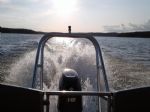
The Truman Reservoir (also known as Truman Lake) is located in the state of Missouri, United States. It is the largest man-made lake in Missouri and the dam that created and manages the lake's water level. It is located between Clinton and Warsaw, on the Osage River and extends south to Osceola. The dam is located in Benton County, but the reservoi...
|
|
|
|
Lake Wappapello is a reservoir on the St. Francis River, formed by Wappapello Dam. Created in 1941, this 45,000-acre lake is located 120 miles south of St. Louis, Missouri. Its primary purpose is flood control though it has evolved into a recreational area with ample opportunities to boat, fish, swim or camp. The reservoir lies overwhelmingly in Wa...
|
|
|
* Full Pool - Highest normal summer pool level before flood stage
** MSL - Mean (average) feet above sea level
|
|

